
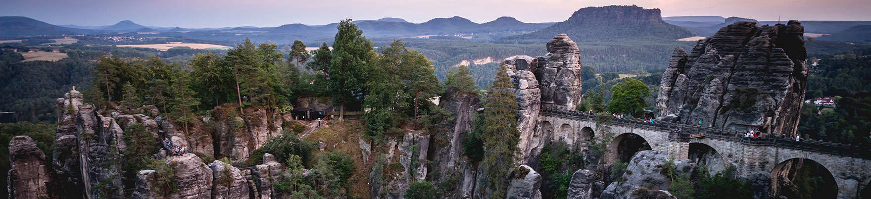
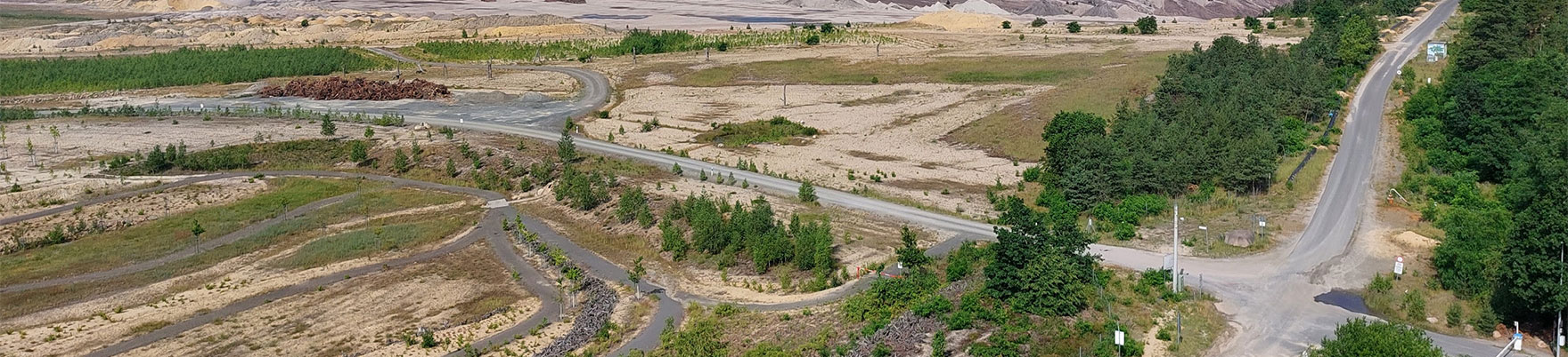
DGGV Annual Meeting 2024
Dresden, 23 – 26 September 2024
GEO
SCIENCES
without
borders
DGGV membership: Join us!
Topics & Sessions
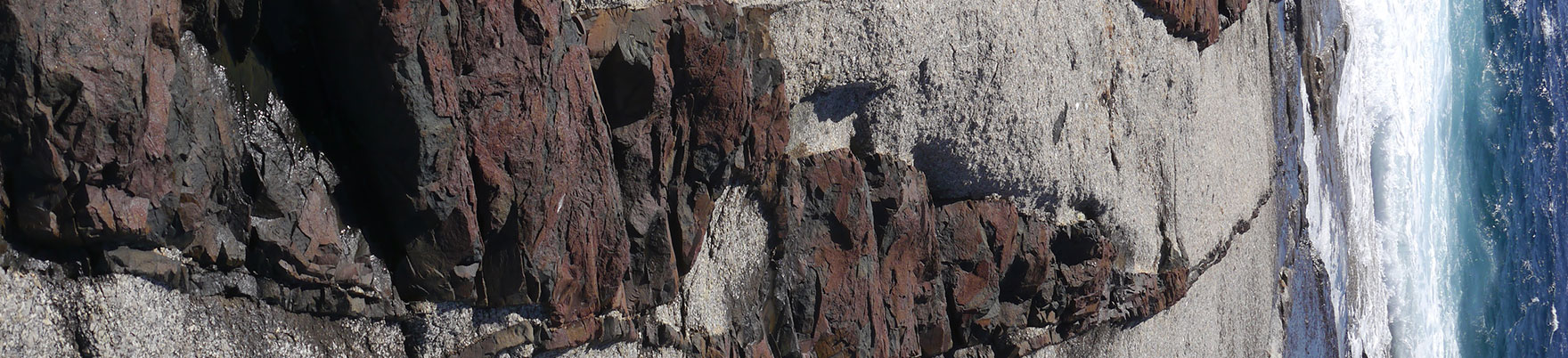
Topic: 01 Regional Geology and Palaeogeography
Topic: 03 Mineral Resources (Minerals, Ore Deposits, Exploration, Mining)
Topic: 04 Geothermal Resources
Topic: 06 Isotope Geology, Geochronology
Topic: 07 Palaeontology, Palaeoecosystems, Palaeoenvironments
Topic: 08 Understanding the Earth System – From Endogenic to Exogenic Processes that Shape the Earth
Topic: 09 Early Earth Processes and Long-Term Earth and Planetary Evolution (cancelled)
Topic: 10 Recent Developments of Geoanalytical Methods
Topic: 11 Anthropocene and Anthropocene Biodiversity Loss (cancelled)
Topic: 12 Earth and Society: Climate, Sustainability and Environment
Topic: 13 Managing the Future of Earth Sciences: Data, Citizen Science, Education, Outreach
Sessions
Topic: 01 Regional Geology and Palaeogeography
1.a) Recent advances in geophysical and geological data integration, modeling and interpretation of the Central European Variscides
Fazlikhani, Hamed (1); Kroner, Uwe (2); Buske, Stefan (3); Nagel, Thorsten (2)
1: Friedrich-Alexander-Universität (FAU) Erlangen-Nürnberg, Germany;
2: Department of Geology, TU Bergakademie Freiberg, Germany;
3: Department of Geophysics and Geoinformatics, TU Bergakademie Freiberg, Germany
Keynote speaker: Dr. Felix Hloušek
The architecture of the Central European Variscides is characterized by the adjacence of rock units that experienced evolutionary steps at different segments of the orogen. For example, early Carboniferous synorogenic marine basins are juxtaposed with crystalline complexes coevally experienced ultra-high-pressure metamorphism. Multiple events of high-pressure metamorphism and subsequent rapid exhumation are eventually followed by a late Variscan high-temperature overprint and the intrusion of voluminous granitic suites. In recent years, the acquisition of new geophysical and geological data and more powerful imaging, data integration and modeling tools have led to a better constraint of the Variscan orogeny. To foster multidisciplinary approaches, this session gathers contributions presenting new data sets of all fields of geosciences encompassing all crustal levels. This includes results of geophysical (seismic reflection and refraction, gravity and magnetic anomaly data), and geological data from tectonic, petrological, geochronological, geochemical, sedimentary/stratigraphic investigations.
1.b) 3D Geological Modeling: Technical Advancements and Regional Geological Insights
Bense, Frithjof A. (1); Ziesch, Jennifer (2); von Goerne, Gabriela (1)
1: Bundesanstalt für Geowissenschaften und Rohstoffe (BGR), Germany;
2: Landesamt für Bergbau, Energie und Geologie (LBEG), Germany
This session aims to provide a comprehensive exploration of 3D geological modeling, dealing with technical innovations and the contributions of regional studies to geological knowledge, integration of geological data, structural geology modeling and visualization techniques essential for a nuanced understanding of subsurface structures.
The session shall also give space to discuss the challenges of data integration, the role of geostatistics in refining 3D models, and the application of cutting-edge software tools. Emphasis will be placed on the significance of regional 3D modeling studies in capturing local geological nuances.
Topics include but are not limited to:
- Challenges and strategies in integrating diverse geological data into 3D models.
- Innovations in structural geology modeling techniques and software
- Uncertainty of 3D Models: Methods for assessing and quantifying uncertainty in geological models and/or case studies highlighting the impact of uncertainty on geological interpretations.
- Regional 3D modeling studies: capturing local geological features, enhancing regional geological knowledge.
- Parametrization for Subsurface Mapping: Explore the parametrization of 3D-volume models, incorporating crucial parameters (e.g. seismic velocity, porosity or temperature), to enhance the characterization of subsurface structures and resource distribution for more accurate subsurface mapping.
- Applications of 3D modeling in simulation, reservoir characterization, mining geology, and hydrogeological modeling.
- The intersection of 3D modeling with emerging technologies, such as machine learning and artificial intelligence.
1.c) Regional geology and palaeogeography
Meinhold, Guido
TU Bergakademie Freiberg, Germany
Regional geology is an important cornerstone of geosciences and provides the foundation for palaeogeographic reconstructions. Regional geology and palaeogeography are used to solve a wide range of questions in geosciences and provide important information in the search for natural resources. This broad session offers the opportunity to explore the diversity of methods and approaches used to study regional geology and develop palaeogeographic maps as well as how information about regional geology and palaeogeography is made available and transferred to the geoscience community in academia, industry, government, or the public. We welcome contributions on all aspects of geology that contribute to a better understanding of the regional geology and palaeogeography of Earth or other terrestrial planets.
2.a) Stratigraphy – dissecting geological time
Ifrim, Christina (1); Becker, Ralph Thomas (2); Zieger-Hofmann, Mandy (3); Wilmsen, Markus (3)
1: Staatliche Naturwissenschftliche Sammlungen Bayerns, Jura-Museum;
2: Universität Münster;
3: Senckenberg Naturhistorische Sammlungen Dresden
Keynote speaker: David de Vleeschouwer, Universität Münster
”Advancing towards an astronomically-calibrated Devonian timescale: Harmonizing cyclostratigraphies between Europe and North America”
Stratigraphy is an essential discipline of geosciences that provides the temporal framework for the complex geological and evolutionary processes that shaped the Earth system for more than four billion years. Recent major advances in temporal resolution resulted from integrated approaches applying high-resolution biostratigraphy, cyclostratigraphy, chemostratigraphy, magnetostratigraphy, geochronology and sequence stratigraphy. This session invites contributions from all fields of stratigraphy and all periods of Earth history, Precambrian to Neogene, that aim to advance the resolution of geological time scales and to improve our understanding of the Earth system. We especially encourage contributions from applied research in order to highlight the importance of stratigraphy for the solution of societally relevant geoscientific problems such as carbon capture and storage projects or groundwater management.
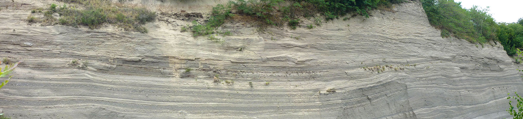
2.c) Sedimentary basins across time: exploring sedimentary strata and their depositional environments
Andrić-Tomašević, Nevena (1); Meinhold, Guido (2); Methner, Katharina (3); C.G. Ravidà, Domenico (4); Tofelde, Stefanie (5)
1: Institute of Applied Geosciences, Karlsruhe Institute of Technology, Germany
2: TU Bergakademie Freiberg, Germany
3: Institute for Earth System Science and Remote Sensing, Leipzig University, Germany
4: Department of Structural Geology and Geothermics, Geoscience Center, University of Göttingen, Germany
5: Universität Berlin, Institute of Geological Sciences, Germany
This session invites contributions regarding the latest findings and insights into the processes, environments, and significance of sedimentary systems. Whether you are investigating ancient sedimentary rocks, and modern depositional environments, or exploring the intricate processes of sedimentary basin evolution, this session aims to provide a platform for knowledge exchange. The session’s focus encompasses a broad spectrum of sedimentological studies, including but not limited to depositional environments, diagenesis, provenance analysis, and the application of cutting-edge methodologies. Participants are encouraged to present research that unravels the complexities of sedimentary archives, shedding light on Earth's dynamic history and thus unraveling the secrets held within the Earth's sedimentary record.
Sedimentary basins are critical archives for understanding the Earth’s surface response to environmental disturbances, including climate changes, and serve as the primary field for reconstructing Earth’s evolution throughout geological time. Moreover, they offer insights into the mechanisms controlling natural hazards, pollutant transport across the land, the genesis and preservation of natural resources, as well as potential gas/waste storage sites and geothermal reservoirs. Therefore, understanding the processes operating in sedimentary systems is pivotal to effectively address societal challenges such as global warming, natural resources management, energy transition and security by providing a scientific basis for sustainable development strategies.
Here, we invite contributions that utilize multi-disciplinary approaches to investigate and characterize sedimentary successions aiming to retrieve insights about (1) the evolution of depositional environments and the impacts of environmental perturbations – such as changes in climates or tectonic settings – on their development across various temporal and spatial scales; (2) the drivers, magnitudes and frequencies of natural hazards such as mass wasting processes; (3) the quantification of the rates of erosion, sediment transport and deposition. Contributions are welcome from field observations, subsurface studies, proxy reconstructions, as well as physical and numerical modelling that take a holistic approach to understanding the evolution of marine and terrestrial sedimentary systems as recorders of changes in climate, ecosystems and/or tectonics/geodynamics.
Topic: 03 Mineral Resources (Minerals, Ore Deposits, Exploration, Mining)
3.a) Mineral Exploration, Economic and Ore Deposit Geology
Kolb, Jochen (1); Frenzel, Max (2); Graupner, Torsten (3); Hector, Simon (1); Fuchs, Sebastian (3)
1: Institut für Angewandte Geowissenschaften, KIT, Germany;
2: HZDR, Germany;
3: BGR, Germany
The transition to a greener world will require an intensification of mining activities on land, and perhaps in the deep sea. This intensification will only be possible if a sufficient amount of new resources can be discovered, and their exploitation made more sustainable. We want to address these global issues in this session through a broad spectrum of contributions related to all aspects of mineral deposits. We particularly invite submissions dealing with 1) the geology of ore deposits and advances in our scientific understanding of mineral systems, from source to sink; 2) mineral exploration and the development of new approaches and technologies; and 3) mining and physical and chemical processing of ores and waste products and how this can be made more sustainable. Studies from across the world, and on all metals and industrial minerals are welcome, with a focus on strategic and critical raw materials.
3.b) Communicating responsible management of natural resources
Wittenberg, Antje (1); Gabriel, Zbyněk (2); Dobnikar, Meta (3)
1: Bundesanstalt für Geowissenschaften und Rohstoffe (BGR), Germany;
2: Czech Geological Survey (CGS), Czech Republic;
3: Geološki Zavod Slovenije (GeoZS), Slovenia
Keynote speaker: Bianca Derya Neumann; EGRM Resource Management Young Member Group (RMYMG), UNECE
Natural resources are a fundamental and precious asset for our societies and economies. The demand for all kinds of natural resources might it be minerals (primary and secondary), groundwater, fossil or hydrothermal resources, is swelling due to the growing global population demanding its share of these resources, while the pressure on the environment and space is increasing. The challenges associated with resource utilisation require the use of a large amount of detailed information. Preparing these multidisciplinary collected scientific data, including detailed technical information, in an understandable form for a wide range of interested parties is a challenge on its self. Reliable information and coherent data are certainly key, but they need to be evaluated, interpreted and communicated likewise well to be useful for resource management. This session will provide an opportunity to share experience on the application of various standards and codes such as CRIRSCO, the United Nations Framework Classification of Resources (UNFC) and United Nations Resource Management System (UNRMS) and the developments therein.
The session is designed to bring scientists together who are dealing with natural resources of any kind and who either prepare reports on resources and reserves or who need to use these reports. Ideas and developments in the field of resource management can be discussed and expanded to meet the critical needs of society. We particularly encourage young researchers to present their ideas in this session.
3.c) Biohydrometallurgy for Biomining, Metal recycling and Bioremediation
Hedrich, Sabrina (1); Schippers, Axel (2); Pollmann, Katrin (3)
1: TU Bergakademie Freiberg, Germany;
2: Bundesanstalt für Geowissenschaften und Rohstoffe - BGR, Germany;
3: HZDR, Helmholtz Institute Freiberg for Resource Technology, Germany
Biohydrometallurgy uses specific capabilities of microorganisms for metal extraction and recovery. Biomining is the industrial application of bioleaching for metal extraction from low-grade or complex sulfide ores mainly for the recovery of copper, cobalt, gold, nickel and zinc. Research has demonstrated metal recovery via bioleaching also from oxide ores such as laterites and of mining residues such as mine tailings as well as metal recycling from industrial residues such as slags, filter residues and electronic waste (secondary mining). Metals being leached have to be recovered from polymetallic solutions which is possible via biosorption or biomineralisation. These bioprocesses are also relevant for the treatment of process waters such as acid mine drainage for metal recycling and bioremediation.
3.e) Mineralische Baurohstoffe – in Forschung und Inwertsetzung
Vulpius, Bert (1); Reimer, Wolfgang (2)
1: Unternehmerverband Mineralische Baustoffe UVMB, Germany;
2: Geokompetenzzentrum Freiberg e.V., GKZ Freiberg e.V.
In Deutschland werden in jedem Jahr zwischen 500 und 600 Millionen Tonnen heimischer Steine- und Erden-Rohstoffe gewonnen, aufbereitet und weiterverarbeitet. Diese stellen wichtige Vorleistungen für die Bauwirtschaft und Denkmalpflege, sowie wichtige Grund- und Ausgangsstoffe für zahlreiche Industriezweige dar und gehören mengen- als auch wertmäßig zu den bedeutendsten Rohstoffen in Deutschland.
Sand, Kies, Kalkstein, keramische Rohstoffe, Festgesteinsrohstoffe wie auch der heimische Naturwerkstein stehen für regionale Wertschöpfungsketten, kurze Transportwege, hohe Umweltstandards und Dekarbonisierung. Ohne diese Rohstoffe, sind die Ziele der Deutschen Nachhaltigkeitsstrategie nicht zu erfüllen.
Die Sicherung des Zugangs zu einheimischen Rohstoffen, ihre Promotion und ein gesellschaftlicher Konsens über deren Nutzung stellen wichtige Aufgabe dar, in die sich die Geowissenschaften in vielfältiger Weise einbringen können und sollten.
Die Erkundung von Lagerstätten, die Auswertung, Digitalisierung und Bereitstellung von geologischen Daten ist eine grundlegende Voraussetzung nicht nur für unternehmerische Entscheidungen, die den Abbau und die Nutzung der Lagerstätte betreffen, sondern auch für die Sicherung von Lagerstätten im Rahmen der Landes- und Regionalplanung. Für die Inwertsetzung sind zudem wichtige Parameter zu bestimmen, die über die spezielle Verwendbarkeit des Gesteins entscheiden. In diesen Prozess sind viele Akteure eingebunden von der Rohstoffindustrie, über Gutachter- und Ingenieurbüros, die Staatlichen Geologischen Dienste bis hin zu Universitäten und Hochschulen.
Trotz der hohen Nachfrage nach heimischen Baurohstoffen und der volkswirtschaftlichen Bedeutung ist deutlich wahrnehmbar, dass Projekte der Rohstoffindustrie zunehmend auf Akzeptanzprobleme bis hin zur völligen Ablehnung stoßen. Ein Grund dafür sind unter anderem Defizite im Bereich der geowissenschaftlichen Bildung. Während das Umweltbewusstsein in den vergangenen Jahren erheblich gewachsen ist, ist das Rohstoffbewusstsein relativ schwach entwickelt. Für die Geowissenschaften bietet sich hier ein breites fachübergreifendes Aufgabenfeld.
Die Steine- und Erden-Industrie bietet Geowissenschaftlern ein breites berufliches Betätigungsfeld, ob in der privaten Wirtschaft oder der öffentlichen Verwaltung. Welche Anforderungen erwachsen daraus für die universitäre Ausbildung?
3.f) Exploration of Evaporites and their importance for Resources
van der Klauw, Sebastiaan; Jockel, Andreas
ERCOSPLAN, Germany
This session aims to bring together geologists and mining professionals that look at the economic aspects of evaporite rocks in a very wide sense, e.g. to define Mineral Resources of potassium- and magnesium-bearing salt rocks, rock salt, nahcolite or other evaporite minerals, as a potential storage host rock (e.g. natural gas or H2 storage caverns, storage of radioactive waste), as a sealing horizon in the hydrocarbon industry, as sources of brines (e.g. salars) to extract for example lithium or also geologists working with metamorphized evaporites as a source for special minerals. Because of their high solubility and their very specific rheological properties, the exploration and characterisation of rock salt and Potassium- Magnesium salts rocks, pose different constraints compared to other exploration concepts and in later phases of a project also constrains the design of the underground openings. This session invites contributions regarding evaporite rock aiming at traditional exploration concepts and new development, the genesis of these rocks, results of mineral resource estimation, geotechnical and geomechanical investigations as well as modelling. The differing types of economic value of the evaporites for the far-ranging purposes mean that geologists working in the various fields have a different focus when they look at evaporite rocks. The objective of this session is to get specialists from numerous fields together to present their work with the expectation that all will benefit from having looked at evaporites from a perspective diverging from their own.
3.g) Advances in pegmatite exploration
Wolfgang Reimer
GKZ Freiberg e.V., Freiberg, Germany
A number of critical and strategic raw materials are enriched in pegmatite type deposits (e.g. Li, Si, REE). At global level pegmatites are major hard rock lithium resources and currently contribute to more than 50% of the overall lithium extraction. In Europe LCT pegmatites are seen as the major supplier for raising the share of domestic lithium production up to 25% in the mid term. NYF pegmatites are being mined for high purity quartz in Norway for use in the production of solar panels, fibre optics, crucibles and semiconductors. Here too the European geology provides substantial unlocked high purity quartz and feldspar occurrences to feed the EU raw materials supply chain. However, most of the LCT and NYF pegmatites are deeply buried and hidden. In recent times they became subject to extensive exploration not only in Europa but also in the US, Canada and southern Africa.
The session aims at advances in LCT-NYF pegmatite exploration at global level with a special focus on Europe. The requested presentations should provide insights into models of pegmatite genesis and setting, as well as new technology, workflows, and methodologies for prospecting and exploration. Recent advances in data analysis, e.g. machine learning, reveal unencountered data insights. State-of-the-art equipment and technology developments provide new means of exploration for pegmatites. Contributions from the full spectrum of methods and disciplines are therefore welcome, addressing different exploration scales, geology, geophysics, geochemistry, and petrology, covering remotely sensed data to ground data and drill core analyses. The range of applicability covers base research up to Technical Readiness Level (TRL) 8. The target groups are the mineral exploration and mining industry as well as the academic research community.
Topic: 04 Geothermal Resources
4.a) Geothermal Resources – from Play Analysis to Case Studies
Moeck, Inga (1); von Goerne, Gabriela (2)
1: Georg-Augut Universität Göttingen, Germany;
2: Bundesanstalt für Geowissenschaften und Rohstoffe, Germany
In face of the energy transition, the growing need for renewable heat is driving up the demand for geothermal energy. Various technologies are available for sustainable geothermal use of the geological subsurface. In recent years, the geothermal play type concept has been developed to estimate suitable resources, in which the dominant heat transport process and the geological control factors are analyzed. The resource analysis according to the play type concept combines the social-technical with the geological-technical potential of a location. From this perspective, this session invites speakers to present latest research results in both geoscientific methods for subsurface characterization as well as social topics regarding demand analyzes and acceptance building. In addition, we invite case studies and reservoir engineering aspects as THMC modelling to demonstrate the utilization potential of geothermal resources from shallow to deep. Ultimately, this session will underline the key role of geosciences in the development of sustainable energies as geothermal energy.
4.b) Deep Geothermal Energy of hydrothermal fault related and petrothermal systems: from geoscientific subsurface data to drilling engineering
Kämpf, Horst (1); Reich, Matthias (2)
1: Deutsches GeoForschungsZentrum (GFZ), Sektion 3.2 - Organische Geochemie, Germany;
2: Technische Universität Bergakademie Freiberg, Institut für Bohrtechnik und Fluidbergbau, Germany
Hydrothermal power plants already run successfully in the sediments of the Molasse basin, the North German basin and in the Upper Rhine valley. Most of the state of Saxony and adjacent areas comprises of crystalline rock thus only offering the use of hydrothermal fault related or petrothermal systems.
Hard rock drilling however is very cost-intensive and however hydrothermal fault related and petrothermal geothermal energy has not really been developed in crystalline rock in Germany – in spite of its large potential!
In order to develop deep geothermal energy projects at crystalline rock areas in Germany, geoscientific subsurface data from geology, geochemistry and geophysics and new processes and technologies needs to be developed so that
- the required deep boreholes in hard rocks can be drilled at comparable costs to sediment drilling operations,
- natural fractures and faults in the formation, which can be used as flow ways for the geothermal fluids can be detected and targeted during directional drilling operations,
- a safe monitoring of the operation of the power plant with regards to the avoidance of induced seismic activities in the formation is given.
The session offers a platform to discuss results and perspectives related to deep geothermal energy projects in crystalline rock (hydrothermal, petrothermal and closed systems) in Germany and neighboring countries.
Topic: 05 Applied Geology, Geo-Engineering, Climate Engineering (Carbon Capture, Sequestration, etc.)
5.a) Host rock characterization and long-term safety of deep geological repositories for high-level radioactive waste
Cichy, Sarah (1); Glotzbach, Christoph (2), Nilius, Nils-Peter (1); Raith, Alexander (1); Rempe, Marieke (1); Schütz, Felina (3); Weitkamp, Axel (3); Wolf, Jens Willhelm (4)
1: Bundesgesellschaft für Endlagerung mbH, Germany
2: Eberhard Karls Universität Tübingen, Germany
3: Bundesanstalt für Geowissenschaften und Rohstoffe, Germany
4: Gesellschaft für Anlagen- und Reaktorsicherheit (GRS), Germany
The safe and permanent deep geological disposal of nuclear waste is a key challenge for society in the 21st century. Geological data and material properties of potential host rock formations serve as input parameters for subsurface models and numerical simulations of the long-term integrity of the geological barrier of a potential repository. In Germany, where the current stage of the site selection procedure does not allow data acquisition in areas considered favorable for the safe and final disposal of high-level radioactive waste, model input parameters typically originate from existing data or from the study of natural and artificial analogues. This session invites contributions presenting geological and geophysical field studies as well as in-situ and laboratory investigations of potential host rocks and overlying sediments, suitable analogues and their material properties in the context of nuclear waste disposal.
5.b) Blurring boundaries and rising responsibilities? – Geoscience & Society
Bohle, Martin; Elger, Kirsten; Ellger, Christof; Grutzpalk, Jonas; Hildebrandt, Dominic; Ifrim, Christina; Kaldich, Annett; Lau, Maximilian P.; Lorenz, Melanie; Peterek, Andreas; Semmler, Malte
As anthropogenic change unfolds on a planetary scale, the interconnectedness of geoscience and society becomes ever more apparent, with the result that our professional responsibilities need adjustment. As a starting point for the discussion of such adjustments, this session gathers contributions from geoscience, anthropology and philosophy involving research, conversation, curating and educational approaches. Contributions present past, current and future geo-societal challenges.
5.c) Groundwater under quality stress — hydrogeochemical consequences of human action
Banning, Andre; Ortmeyer, Felix
University of Greifswald, Germany
Groundwater as a resource is exposed to a variety of anthropogenically induced stressors. Numerous potentially eco- and/or human-toxicologically relevant substances are now known to reduce groundwater quality and impair its fulfillment of important ecological and water management functions. Examples include the much-discussed (yet unsolved) nitrate problem, inputs of pesticides, biocides and industrial chemicals or their degradation products. Mining still plays a major role as an emitter of contaminants to groundwater, and will keep doing so for the foreseeable future. Climate change will be a key trigger and multiplier for groundwater quality deterioration.
With the adoption of the UN Sustainable Development Goals (SDGs) in 2015, groundwater protection has reached the highest political level, with SDG 6 (Clean water and sanitation) stipulating not only the provision of safe drinking water, but also the protection of groundwater bodies themselves. This results in a significant need for research and action, including identification of sources and mobilization mechanisms, understanding of transport, degradation and accumulation processes, improvement of laboratory analysis and numerical modelling, strategies for risk management, substitution of problematic substances, remediation approaches, and derivation of guidelines.
This session is intended to take a closer look at current developments and research results on groundwater quality issues, regionally focusing (but not limited to) European settings. We encourage submission of studies covering the entire methodological spectrum from field to laboratory to modeling approaches. Innovative contributions from basic and applied research as well as from hydrogeochemical and regulatory practice are welcome.
5.f) Hydrogen in the energy transition –white to green hydrogen and subsurface storage
Febbo, Maria Belén (1); Cheng, Chaojie (2); Hasch, Maximilian (3); Ostertag-Henning, Christian (3); Weisenberger, Tobias Björn (1)
1: Helmholtz-Zentrum Potsdam - Deutsches GeoForschungsZentrum GFZ, Germany;
2: Institute of Applied Geosciences, KIT – Karlsruhe Institute of Technology, Germany;
3: Federal Institute for Geosciences and Natural Resources (BGR), Germany
Hydrogen has become a key element in the energy transition due to its potential as an energy carrier. A growing number of countries have published hydrogen strategies. These include different ways to source hydrogen and to store hydrogen. In recent years, the discovery of natural hydrogen has attracted attention of scientists. This raises hope that in the future natural hydrogen can be made available in economically significant quantities. The cyclic underground storage of hydrogen can help balance periodic energy deficiency and excess caused by seasonal renewable energy production and changing demand. The subsurface storage enables medium- to large-scale storage of hydrogen in salt caverns, saline aquifers or depleted hydrocarbon reservoirs.
In the field of natural hydrogen occurrences, scientists are encouraged to present their work on formation mechanisms and transport processes, as well as trapping mechanisms for hydrogen. This includes, but is not limited to, geochemical reactions of hydrogen formation or oxidation, associated mineralogical changes, and microbiological reactions.
We welcome contributions from laboratory experiments, modelling, and simulation studies that address those important processes, either in the natural occurrence of hydrogen, or during subsurface hydrogen storage. The investigations can encompass a wide range of mechanisms on micro- to macroscopic scales, including first attempts to come up with guidelines in exploration for natural hydrogen or its resource assessment.
Topic: 06 Isotope Geology, Geochronology
6.a) Chemical Sediments as Archives of Earth Surface Conditions
Tatzel, Michael (1); Stamm, Franziska (2); Frings, Patrick (3); Bajnai, David (1)
1: Universität Göttingen, Germany;
2: Technische Universität Graz, Austria;
3: Geoforschungszentrum Potsdam, Germany
Keynote speaker: Prof. Sonja Geilert, Utrecht University
Chemical and biological sediments form and lithify at or near the Earth’s surface. These sedimentary rocks can provide crucial insights into the environmental conditions on Earth in the geological past through their geochemical and isotopic fingerprint. These fingerprints allow us to reconstruct aspects of the physical and chemical conditions of the water-rock system during the sediment’s formation, such as pH, temperature, redox state, or element concentrations. However, both ‘vital effects’ and diagenesis can hamper interpretations of sediment geochemical signatures. This session aims to bring together contributions that decipher records in (bio)chemical sediments using experimental, modeling, and empirical approaches. We also welcome research on proxy development.
6.b) Isotopes in geosciences: Geochronology and provenance
Zieger-Hofmann, Mandy; Zieger, Johannes
Senckenberg Naturhistorische Sammlungen Dresden, Germany
Keynote speaker: Dr. Axel Gerdes, Goethe Universität Frankfurt/Main, Institut für Geowissenschaften, Fachbereich 11:
"U-Pb geochronology: the achievements of the last 10 years, our limits, and what's next?"
Isotopic analyses play a crucial role in setting the framework for the study of geological phenomena. They serve as a fundamental aspect of various earth science disciplines, providing the essential data needed to determine the processes, rates and timescales that affect and influence our environment. As analytical capabilities continue to advance, so do the possibilities. Improved accuracy, precision, and spatial resolution of established and new techniques are contributing to an unprecedented level of detail and complexity in isotopic investigations. As a result, isotopic analyses form the basis of both geochronological analyses and provenance interpretations.
This session aims to provide an overview of the current state of isotopic methods in geoscience and their applications. Contributions are encouraged on topics such as analytical advances, new approaches, developments in provenance studies, database studies, etc.
Topic: 07 Palaeontology, Palaeoecosystems, Palaeoenvironments
7.b) Palaeoenvironmental analysis from proxies
Wilmsen, Markus (1); Wotte, Thomas (2)
1: Senckenberg Naturhistorische Sammlungen Dresden, Germany;
2: TU Bergakademie Freiberg, Institute of Geology, Germany
Complex geological and evolutionary processes shape the face of the Earth for almost four billion years. Considerable advances in palaeoenvironmental research have been made recently by interdisciplinary approaches that integrate classical palaeontological analyses with sedimentology, sequence stratigraphy, stable isotope systems and sedimentary geochemistry within high-resolution temporal frameworks. Proxies used include trace and body fossil assemblages, organic, inorganic and isotope geochemistry as well as sedimentological and palaeoecological approaches. This session invites contributions from all fields of proxy-based palaeoenvironmental research and all periods of Earth history, Precambrian to Quaternary, that aim to improve our understanding of ancient environments and their biota and to track their variations in time and space. We especially encourage contributions reflecting the broad variety of isotopic and elemental systems as well as innovative analytical methods applied to marine and non-marine geomaterials in order to get more precise insight into the Earth’s changeable history.
Topic: 08 Understanding the Earth System – From Endogenic to Exogenic Processes that Shape the Earth
8.a) Magmatism, volcanism, and related processes
Walter, Thomas R. (1); Gevorgyan, Hripsime (2); Büchner, Jörg (3); Repstock, Alexander (4); Uhl, Dieter (5)
1: GFZ, Germany
2: Institute for Mineralogy, TU Bergakademie Freiberg, Germany;
3: Section of Geology, Senckenberg Museum of Natural History Görlitz, Germany;
4: Section of Geological Survey and Geophysics, Saxon State Office for Environment, Agriculture and Geology Freiberg, Germany
5: Senckenberg Forschungsinstitut und Naturmuseum Frankfurt, Germany
Keynote: Valentin R. Troll from Uppsala University, Dept. of Earth Sciences, Natural Resources & Sustainable Development (NRHU)
This session aims to discuss processes of fluid flow, magmatism, and tectonism, unraveling the dynamic relationships that shape Earth's crust from its interior to the surface. Understanding these processes and possible interactions is essential for comprehending the complex geological phenomena. From the depths of the crust to the Earth's surface, contributions to this session investigate the roles of fluids in mobilizing materials, associated magmatic activity, and contributing to tectonic processes and fault (re)activations.
We invite contributions that examine the migration of fluids through the crust, tracing their pathways and investigating their impact on the mechanical and chemical properties of rocks, pathways through volcanoes, and alteration of materials. The integration of volcanism and magmatism into the framework of fluid-rock interactions reveals a dynamic interplay that shapes the Earth's lithosphere. Magma generation and ascent are influenced by the presence of fluids, impacting the composition and style of volcanic eruptions. Concurrently, tectonic forces exerted on the crust contribute to the spatial and temporal distribution of magmatic activity. The link between tectonic processes and magmatism is essential for deciphering the broader geological context and understanding the feedback mechanisms that govern Earth's evolution.
We also welcome researchers who are analysing the surface expression of volcanoes, dike intrusions, faults and fluid expulsion, as well of seismicity and deformation, and the experimental, analog or numerical modelling of fluids and their propagation paths. Possible methods include surface mapping, geomorphology, remote sensing, in-situ monitoring and observation, drone based sensing, gas analysis and much more.
Rift-related volcanism: Achievements and perspectives from macro to micro scale
Volcanism at divergent plate boundaries and intracontinental rifting zones produces various spectra of monogenetic to polygenetic volcanic structures, develop several eruption styles, and exhibit complex magma systems from mantle to surface. This precisely shows the necessety of joint and multifarious research to unravel and comprehend the processes of rift-related magmatism throughout Earth's geological history. This includes everything from large-scale reconnaissance surveys to X-ray microanalyzes. To contain a consistent view of such volcanism, this session encompasses various aspects of physical volcanology, geophysics, igneous petrology, and mineralogy. We welcome scholars exploring multifarious aspects of volcanoes, concerning their pre-eruptive history (crystallization conditions, magma dynamics) and syn-eruptive processes (growth and degradation of volcanic structures), as well as post-volcanic activities (alteration/ weathering).
8.c) Latest Achievements in Scientific Ocean and Continental Drilling
Grob, Henrik (1); Wiese, Frank (2); Heeschen, Katja (3)
1: Kiel University, Kiel, Germany;
2: Federal Institute for Geosciences and Natural Resources (BGR), Hannover, Germany;
3: GFZ German Research Centre for Geosciences, Potsdam, Germany
Keynote Speaker:
- Keynote 1: Torsten Haberzettl, University of Greifswald "News from the ICDP Project NamCore, Tibet - (hopefully) shortly after the drilling"
- Keynote 2: Ulrich Harms, GFZ Potsdam "Research objectives and key sites of continental scientific drilling"
National and international Earth science programs are utilizing Scientific Drilling as a critical tool to understand climate and environmental variability, geohazards such as earthquakes and volcanic eruptions, natural resources, the deep biosphere and other topics of socio-economic relevance.
The principal goal of the session is to summarize latest scientific achievements in ocean, continental and polar drilling, as well as technical developments in scientific drilling and innovations in the systematic evaluation of well logging data.
8.d) Supercontinents: From Avalonian-Cadomian subduction to Alleghenian-Variscan collision – How Pangea was formed?
Linnemann, Ulf (1); Zeh, Armin (2); Žák, Jiří (3)
1: Senckenberg Naturhistorische Sammlungen Dresden, GeoPlasmaLab, Germany;
2: Karlsruher Institut für Technologie, Institut für Angewandte Geowiss., Germany;
3: Charles University, Institute of Geology and Paleontology, Czech Republic
Keynote speaker:
- Keynote 1: Damian Nance, Athens, U:S.A.
- Keynote 2: Gabriel Gutiérrez Alonso, Salamanca, Spain
The Alleghenian-Variscan orogen and its Avalonian-Cadomian precursers form the heart of the supercontinent Pangea. The Variscan orogen resulted from the continent-continent collision of the landmasses of Laurussia and Gondwana and its peripheral orogens. As the dominant basement of Central and Western Europe, the Variscan mountain chain has been the target of intense geoscientific research for more than a century. Over the past few decades, numerous high quality data sets had been produced in the fields of mineralogy, geochemistry, palaeontology, geology, and geophysics. New robust geochronological data, in particular, has paved the way for new interpretations of the formation of the orogen, the architecture of the orocline, and the formation of mineral deposits. For this session we welcome presentations from all fields of geosciences that bring us closer to answering our core question: How were the supercontinent Pangea and its forerunners formed?
8.e) Tectonic Systems - TSK Open Session
Dielforder, Armin (1); Kenkmann, Thomas (2); Nagel, Thorsten (3); Stipp, Michael (4)
1: Leibniz Universität Hannover, Germany;
2: Universität Freiburg, Germany;
3: Technische Universität Bergakademie Freiberg, Germany;
4: Martin-Luther-Universität Halle, Germany
The open session on tectonics, structural geology, and crystalline geology provides a forum to present and discuss recent research results from active and fossil tectonic settings. We welcome both process-oriented and regional studies that provide insights into a wide range of geodynamic processes, from rifting and ocean spreading to subduction, collision, and intraplate deformation. This session will bring together a diverse community that builds on and advances multimethodological research including mapping, microstructural, geochemical, geochronological, and petrological analyses, as well as analogue and numerical modeling, and concept development. As such, we invite both overarching and thematic presentations from early carrier to senior scientists.
8.f) Interactions between mountain building, climate and biodiversity
Ballian, Armelle (1,2); Meijer, Niels (1); Boateng, Daniel (3)
1: Senckenberg Biodiversity and Climate Research Centre (SBiK-F), Frankfurt am Main, Germany;
2: Institute of Geosciences, Goethe University Frankfurt, Frankfurt am Main, Germany;
3: Department of Geosciences, University of Tübingen, Tübingen, Germany
Keynote speaker:
- Dr. Yanyan Wang; ETH Zürich “Escarpment retreat drives diversification of eastern Madagascar through allopatric speciation”
- Prof. Dr. Peter van der Beek; University of Potsdam “Tectonics, Climate, Erosion and the Relief of Mountain Belts”
Mountain building over geological time is controlled by the interplay between tectonically driven surface uplift and Earth surface processes driving denudation. In return, such surface processes are also controlled by topography affecting regional atmospheric circulation and driving global climate through interactions with the carbon cycle (e.g. silicate weathering, sulfide oxidation). In addition, elevation gradients and relief have produced unique ecosystems and hotspots for speciation. Reconstructing the evolution of topography is therefore crucial in understanding past climate change, geodynamic drivers of mountain building and the distribution of biodiversity.
Disentangling the intricate relationships between topography and climate requires a multi-disciplinary approach for paleoenvironmental and paleoaltimetric reconstructions as well as geodynamic, landscape evolution and climate modeling.
We are therefore inviting a wide range of contributions on topics related to the topographic evolution of various mountains (e.g., European Alps, Andes, Tibet, and Himalayas, among others) and sedimentary records in neighboring basins across various spatial and temporal scales. This also includes recent advancements using tools such as low-temperature thermochronology, luminescence dating, cosmogenic nuclides, stable isotope paleoaltimetry, clumped isotope thermometry, biomarkers, palaeobotany, source-to-sink approaches and geodynamic or atmospheric modeling to quantify the links between the geosphere, climate and biosphere.
Topic: 10 Recent Developments of Geoanalytical Methods
10.a) Recent Developments of Geoanalytical Methods
Möckel, Robert; Renno, Axel
Helmholtz-Zentrum Dresden Rossendorf, Helmholtz Institute Freiberg for Resource Technology, Germany
In modern geological research, geological questions are becoming increasingly complex. May it be geo-chronological, trace element or resource and processing related, the need for accurate and precise complete datasets is increasing. Addressing this need, analytical methods are developing and emerging technologies gaining interest, not only for scientific but also for commercial uses. In addition, the traceable combination of analytical methods will gain in importance, as an increasing number of questions unfortunately cannot be solved with a single method. Also, new technological developments enable us to produce smaller detectors, faster devices, leading to ground breaking applications and results both in the labs and the field.
This session is dedicated to recent developments, frontiers in geoanalytical research and analytical methods in general as well as mobile devices and their applications.
Topic: 12 Earth and Society: Climate, Sustainability and Environment
12.a) Advancements on the distribution, reactivity and behaviour of TCEs in aquatic systems: updates and future research direction
Gil-Díaz, Teba; Eiche, Elisabeth
Karlsruhe Institute of Technology (KIT), Germany
Keynote speaker: Dennis Krämer, BGR
The European Union has identified rare earth elements (REEs), platinum group elements (PGEs), and a series of complementary elements (i.e., gallium, germanium, niobium, indium, tellurium, tantalum and thallium) as both Technology-Critical Elements (TCEs) and Critical Raw Materials. Despite their emerging use and on-going studies/reviews in environmental compartments, there are still several knowledge gaps. Current status of TCE research in aquatic systems is mainly dominated by analytical development and point sampling campaigns. This session aims at compiling the current research status of TCEs in Germany and at acting as a nexus point for collaborations in this research field. With the main focus on current developments and future trends in TCE research, we welcome contributions addressing at least one of the following topics:
- Certified Reference Materials: is there a consensus on TCE validation?
- Speciation and complexes: are they relevant and in which systems?
- Transport mechanisms (e.g., truly dissolved vs colloidal vs nanoparticles): what role do they play?
- Transfer between environmental compartments: is it known/relevant?
- Contamination: are TCEs present at levels of concern?
- Climate change and sustainability: temporal trends and physical-chemical impacts?
- Surface complexation and reactive transport models: are there any for TCEs?
- Extraction methods for recycling/industrial use: are we still aiming at a general understanding of their environmental distribution, reactivity, behaviour and fate in different aquatic systems (surface-, ground-, hydrothermal waters, brines) or is extraction the new goal?
Topic: 13 Managing the Future of Earth Sciences: Data, Citizen Science, Education, Outreach
13.b) Geoscience Education Research - What do we Know About Learning and Teaching geosciences?
Hlawatsch, Sylke (1); Felzmann, Dirk (2); Locke, Sharon (3)
1: Richard-Hallmann Schule, Germany;
2: Universität Koblenz - Landau, Natur- und Umweltwissenschaften, Germany;
3: Southern Illinois University Edwardsville, USA
Keynote speaker: Sharon Locke, professor of environmental sciences and geoscience education, Southern Illinois University Edwardsville, USA
Schools should enable young people to make informed decisions regarding sustainable development of planet Earth. However, German geoscientists and geoscience institutions have repeatedly expressed their concern about the lack of basic geoscience knowledge among the general public and the limited geoscience school education. This is disturbing, because an in depth understanding about the functioning of the Earth as a system, e.g. the development of natural resources or the climate, is an essential prerequisite. Research into teaching and learning has shown that problem solving is not possible without knowledge of the subject matter (Weinert, 2014). Invited are researchers that have been involved in geoscience school education and teacher training, also as part of geography, biology, chemistry, physics education to present and discuss their findings. With this session we aim to illustrate the field of geoscience education research (“fachdidaktische Forschung” in German). We are looking forward to learn for example about prerequisites of the learners and teachers (e.g. their interests, their conceptions, their competencies), the effects of geoscientific learning environments on the cognitive, social, motivational development of the learners, the analysis of alternative teaching concepts or assessments on the situation of geoscience education in various nations. References Weinert, F. E. (Ed.). (2014). Leistungsmessungen in Schulen (3. Aufl.). Beltz.
14.a) Geodata management and 3D visualization techniques
Stueck, Heidrun Louise (1); Ziesch, Jennifer (2); Steuer, Stephan (1)
1: Federal Institute for Geosciences and Natural Resources (BGR), Germany;
2: State Authority for Mining, Energy and Geology (LBEG), Germany
This session invites all contributions that deal with the latest developments and technologies in geodata management and 3D visualization techniques.
Both geodata management and 3D visualization techniques are crucial for efficient utilization and optimization of geological information in different scales, from regional models to very detailed models of single structures. The session therefore focusses on the challenges and solutions in dealing with geodata analysis and processing, as well as database management systems and specific case studies.
Geological 3D models offer numerous benefits for various tasks in both science and economy. However, employing suitable 3D visualization techniques that effortlessly convey the complex details of these models in a clear and engaging manner, not at least for the general public, remains a persistent challenge. We therefore also welcome all contributions that deal with the challenges of 3D visualization techniques, be it through specific examples or in general.
14.b) How can research data infrastructures meet today’s and future needs of the geosciences?
Elger, Kirsten (1); Agemar, Thorsten (2)
1: Deutsches GeoForschungsZentrum GFZ, Germany;
2: Leibniz-Institut für Angewandte Geophysik LIAG, Germany
Keynote speaker: Rebecca Farrington, AuScope Ltd
As Earth and Environmental Sciences become increasingly data-driven, the development of digital tools and research data infrastructures (including repositories) is revolutionising how we explore and understand our planet.
The sharing and processing of geosciences data play a key role in addressing many current societal challenges (e.g. energy, resources, environmental pollution, climate change). While research data repositories are permanent archives and access points for data and metadata, other research data infrastructures, like synthesis databases and specialised information systems aim at bringing data from distributed sources together in order to enable transdisciplinary research (e.g. GeotIS, NFDI4Earth, EPOS, GEOROC, Geoportal etc.).
The session would like to overview the current repositories, data services, and digital tools and issue recommendations on data and metadata provision (e.g. FAIR data principles, certificates etc.). New approaches to finding relevant data will be covered, as will concepts for data handling and visualisation. The session will also focus on concepts and methods to assess and improve the quality and interoperability of data.
This session invites researchers from academia and geological surveys, industry professionals and IT enthusiasts to come together and explore the soaring domain of data provision, data management and data science. Our aim is to discuss experiences, perspectives, strategies, current and future challenges and spark innovative ideas that will shape the future of environmental and Earth sciences.
14.c) Data Meets Earth: AI-Driven Innovations in Geoscience
Broda, Stefan (1); Torizin, Jewgenij (1); Preugschat, Benedikt (1); Nikonow, Wilhelm (1); Brysch, Marco (1); Müller, Simon (2)
1: Bundesanstalt für Geowissenschaften und Rohstoffe (BGR), Germany;
2: Bundesanstalt für Materialforschung und -prüfung (BAM), Germany
Artificial intelligence (AI) and machine learning (ML) become pivotal in driving innovation and discoveries across different scientific fields. This session calls for contributions demonstrating the transformative impact of AI and ML, encompassing various facets of Earth system modeling, such as atmospheric sciences, oceanography, geology, hydrogeology, geophysics, environmental sciences, natural resource management, mine reclamation, climate change analysis, and geological hazard assessment.
We welcome abstracts that illustrate the role of AI and ML in deepening our understanding of Earth's processes and resources. In particular, we encourage submissions employing deep learning, predictive analytics, neural networks, and other ML techniques for data analysis, pattern recognition, and simulation across all scales.
To delve into challenges and opportunities integrating AI/ML with conventional geoscience approaches, we seek discussions on data acquisition, algorithmic transparency, model validation, and ethical considerations in AI-driven geoscience research. Also, we highly value contributions demonstrating interdisciplinary collaborations and innovative data integration and visualization methods.
This session will establish a collaborative and insightful environment for a diverse community of geoscientists, technologists, and educators, allowing us to share advancements and learn from one another in a setting that values thoughtful discourse. In this environment, we aim to collectively explore how AI and ML can be effectively and responsibly used in geosciences, contributing to a deeper understanding of our planet and its environmental challenges.
15.a) Young Scientist Session
Matthies, Fiene (1); Lang, Moritz (2); Arndt, Iris (3); Sawall, Joshua (4)
1: GEOMAR Helmholtz Centre for Ocean Research Kiel, Germany;
2: RWTH Aachen University, Germany;
3: Goethe University Frankfurt, Germany;
4: jDGGV, Germany
The Young Scientist Session offers all young scientists the opportunity to present their latest research among peers. Anyone without a PhD as well as anyone who obtained their PhD within the last 3 years will be considered a young scientist. We especially encourage young scientists who attend a conference for the first time or who are not sure whether their topic fits in another session, to submit contributions. This session invites contributions from all areas within the geosciences. This includes, but is not limited to, contributions based on the latest project, the BSc or MSc thesis, or the progress of a PhD project. The Young Scientist Session aims to give young scientists a platform to present and discuss their latest research in a conference environment with a diverse audience. We are pleased to announce that the best presentation(s) of this year's Young Scientist Session will be honoured with the Young Scientist Award in the form of a certificate and a book prize in cooperation with Springer.
A cordial thank you to
OUR SPONSORS
 GOLDGOLD
![]()
![]()
![]()


![]()
![]()
 SilverSilverSilverSilverSilverSilver2SilverSilver
 BRONZEBRONZE
![]() DIAMOND
DIAMOND
CONTACT
F&U confirm
Permoserstraße 15
04318 Leipzig | Germany
Phone: +49 (0)341 6025 1828
DGGV SOCIAL MEDIA
Abstract-Submission & Program (Mario Helm): geosax-abstract (at) fu-confirm.de
Sponsoring & Exhibition (Susanne Lange): geosax-exhibition (at) fu-confirm.de